
Since I was a child, I’ve dreamed of time-travel— never into the future, always to the past — but the closest I can achieve without magic is traveling amongst history. The Outer Hebrides of Scotland, the Western Isles, proved one of the best destinations to feed my dreams. . They are empty of soaring Gothic cathedrals and have no teeming cities, but I relished experiencing the unchanged locations and vistas of our forebears.
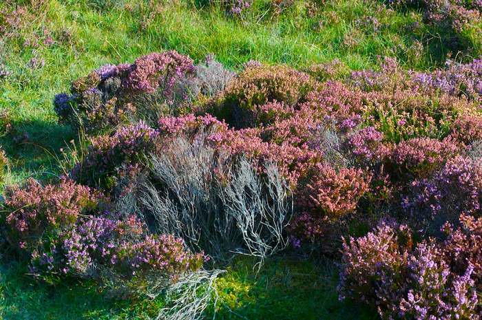
The Wild Heather of the Scottish Outer Hebrides
The Hebrides date back to late-Neolithic times with evidence of settlements from 3000BCE; Celtic Christianity arrived in the 500s; Viking and clan warfare birthed ancient castles; the legends of Bonnie Prince Charlie developed, and recent seafaring and the two World Wars spun new stories.
Last September, I spent a week exploring and soaking up sunshine along with the islands heritage. But I confess I had never heard of the Isles of Uist before I booked my flight and arranged my self-drive tour of the Outer Hebrides.

The Sound of Eriskay with South Uist’s mountains in the distance. SS Politician foundered at its shallow east end (R) due to a navigational error.
The ferry from Barra snugs into its dock on the Isle of Eriskay that lies south of the Uists and I drive into Am Baile, the main village. Only three roads lead in and out, and it takes me less than thirty minutes to see everything. The church of St. Michael high on a hill has an altar made from a WWII lifeboat of the sunken HMS Hermes and a bell salvaged from a scuttled WWI German battle-cruiser. Eriskay’s rich history begins to transport me. Outside the church, I see South Uist’s hills of granite reaching for the sky and wonder what they’d recall if they could but speak.
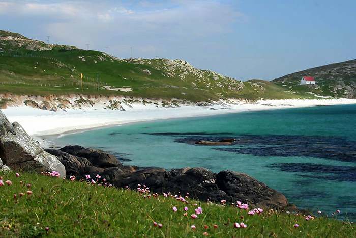
Bonnie Prince Charlie stepped ashore on the Prince’s Cocklestrand, Eriskay, on July 23, 1745. He saw it much as it looks today and began his quest to regain the British throne. (Photo: © Gilbert Summers, ScotlandinaWeek.com)
I stare out to sea from the Prince’s Cocklestrand imagining Bonnie Prince Charlie’s first landing in Scotland in 1745 and his efforts to evade capture. Nearby the only pub on Eriskay is named after a ship, the SS Politician, which foundered in 1941 releasing 240,000 bottles of whisky and becoming the star of Compton Mackenzie’s book and movie, Whisky Galore. The islanders rescued the crew and the whisky, caches of which were buried to dodge the excise officers and they are still being unearthed.
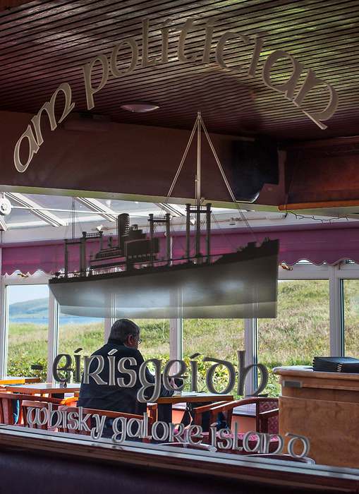
Inside the Am Politician pub where visitors can also see some unearthed bottles of whisky from the wreck. Over the dunes to the left is the prince’s landfall.
A causeway leads me onto South Uist, and I’m facing a long drive to my hotel in North Uist. However, because of good weather and no time to retrace my route, I decide to explore the past and enjoy the magnificent scenery.
The main road north runs along the Atlantic side. On my left, the coast is a twenty-mile beach, much of which is inaccessible, and on my right lie grassy dunes (machair) and peaty moorland with a few crofts. The land farther east rises to purple mountains that form South Uist’s rocky east coast.
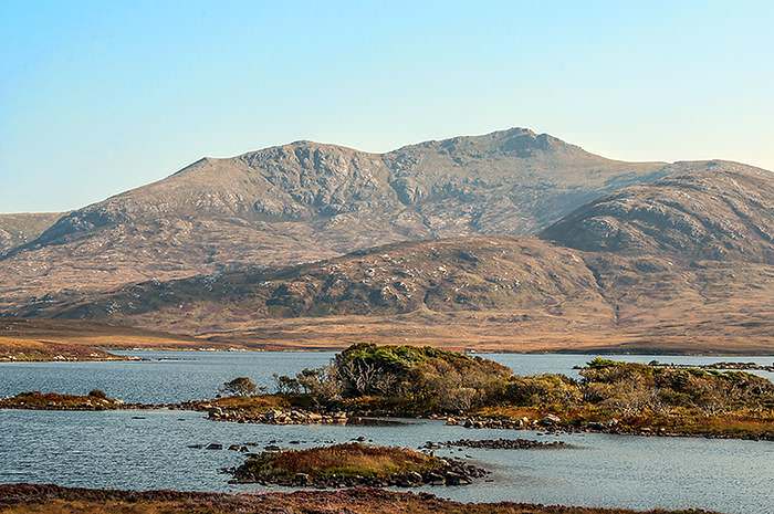
A typical view of South Uist looking inland and east shows the fertile machair, cottages, and the mountains — Ben Mhor, the highest on the right, and Ben Hecla.
My first stop is the Kildonan Museum, a good place to discover more about South Uist. Overwhelmingly Catholic and still a haven of Gaelic culture, the inhabitants have fought to preserve their heritage since the Reformation, and the museum’s exhibits indicate just how hard living was in the 20th century. I walk around the ruins of Ormacleit Castle, one of the last built in Scotland, and photograph the ancient Celtic crosses at Howmore, while admiring the same views of Ben Mhor and Hecla as the monks did before the Vikings invaded.
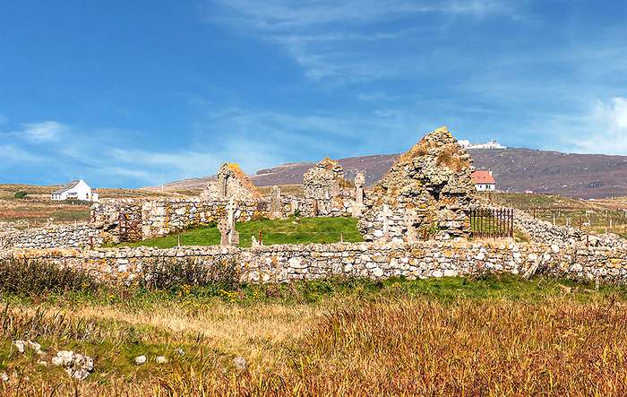
Howmore is the most significant collection of medieval church ruins in the Western Isles. The Celtic crosses in the burial ground and the chapel date from 700CE. The modern buildings on the summit of Ben Rueval are part of the Ministry of Defence Missile Range.
Lastly, I point the car due east and meander across to the other side of South Uist along the wild Loch Druidibeag and Loch Skipport.
Just north and east of Howmore lies the unspoiled, freshwater Loch Druidibeag in the centre of South Uist, which is the best place to see breeding Greylag Geese, otters, and Ben Hecla.
These haunts of today’s birdwatchers and hill walkers offer watery moorland landscapes framed by mountains. I also seek otters, but they elude me once again. At the east end of Loch Skipport, I encounter my first wild Highland ponies near a 19th century herring dock.

A wild Highland pony, a descendant of European Native Ponies bred to Arabian horses from the 1800s, grazes near a ruined cottage at the east end of tidal Loch Skipport. They are hardy, strong, and come in all shades of brown and sometimes grey.
Flat, watery Benbecula, also visited by Bonnie Prince Charlie, is sandwiched between the two Uists, and as time is short, I don’t explore. It glows in the late afternoon sun and beaches beckon causing later regret because I never return. Here too is the airport, which the RAF built in WWII for anti-submarine operations, and now serves tourists flying to Glasgow, Stornoway, and Barra.
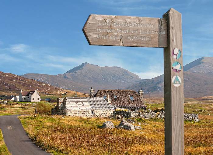
Once on North Uist, I hurtle non-stop across the moors to Lochmaddy and my hotel, knowing I have two days to explore an island that is in stark contrast to its neighbors — an untouched island of more water than it is land. I linger over superb fresh-caught fish in the Hamersay House, the best of two hotels in North Uist, and collapse into a deep sleep.
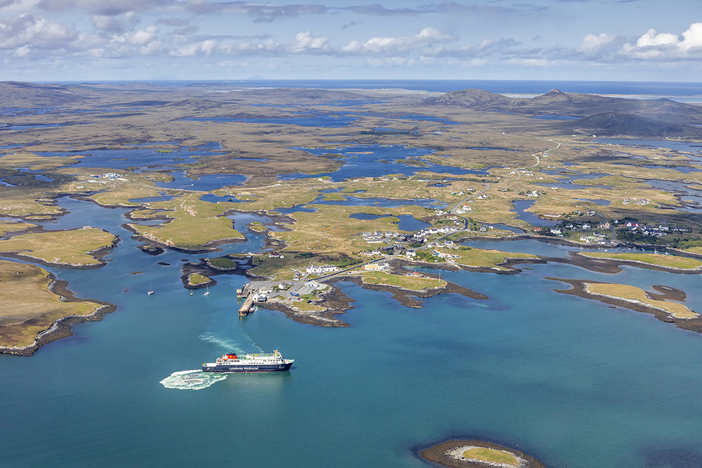
From above, Lochmaddy, the village capital of North Uist and the drowned eastern landscape of peat bogs and lochans — earth and water — stretching to the Atlantic coast in the distance. Once the haunt of pirates, it is now a special marine conservation area. (Courtesy: www.ruralnetwork.scot, © Peter Scott)
Next morning is hot and humid, and I wake with the sniffles. Not the best combination for my plans, so I defer them and poke around Lochmaddy, the main village. The natural harbour and inlets are peppered with islands, which provided a haven for pirates centuries ago. The local museum/art centre is surprisingly informative and worth visiting — North Uist has many ancient Neolithic duns (tombs), standing stones, and cairns if you care to hike into the distant past. I locate today’s only store — it looks like a house —and receive an ancient recipe for colds involving whisky. “Och! Ye’ll be cured in a wee while,” the white-haired clerk says.
Her remedy works overnight. Under another sunny sky, the tide is out — just what I need to photograph the vast beaches and fall colors. I’m still awaiting the right combination of light and setting to capture an award-winning shot of a crofter’s cottage.
The northwest of North Uist has fewer lochs than the east, and the road winds along the coast past sheltered bays, islets, hamlets, and sheep.

On the northwest coast between Trumisgarry and Grenitote, lies a wide, deeply-indented bay with the Isle of Oronsay at it’s entrance.
I stop often, tucking my tiny car as far off the single-track road as I can, and breathe the clean sea air. Time here is still dictated by the tides and the sun, and I wander down unmarked lanes for the sheer delight of seeing round the next corner. But when I get to Vallay Strand, I stand transfixed. The white sand stretches out as far as I can see to a distant island sheltering the bay from the Atlantic. Here, too, is the cottage I’ve sought for three weeks.

This restored blackhouse on the edge of Vallay Strand ended my quest for a perfect image. Beside it is a thatched byre for livestock and peat fuel. At low tide the white beach stretches as far as the eye can see to the Isle of Vallay that is out of the frame. This image was a finalist in McKinlay Kidd’s 2014 photography competition.
Soon Scolpaig Tower looms from an islet in a shallow loch on the only section of northwest Uist without beaches. Sadly it’s not ancient, but the folly of a 19th century laird.
Although I want to stop and see the birds at the Baranald Reserve, I pass and take another unpaved lane into the untouched wilds of history — tidal Loch Euphort almost cuts North Uist in two.
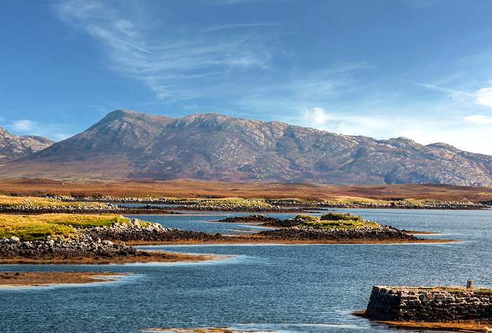
Tidal Loch Euphort penetrates North Uist almost to the west coast and is a latticework of islands and water, as well as a place of solitude and peace. South Lee (Lì na Deas) is the backdrop.
It’s dressed in russet brackens and yellowing grasses, grey granite and purple-splashed heathers. The rutted lane peters out before I reach the east coast and I have trouble turning the car around — a horse would work better here.
Next morning dense fog means I never enjoy the beauty of Bernaray where I await the Isle of Harris ferry. It’s delay has me planning more time-travel to this wild place of land and water, ancient history and remote emptiness that is the Uists.
ADDITIONAL INFORMATION:
- Everything is closed on Sundays on Eriskay and the Uists, even some ferry service and smaller cafés. Hotel bars and restaurants are open in season.
- The islands are served by Caledonian MacBrayne Ferries:
- (Flybe) flies from Glasgow, Stornoway and Barra to Benbecula.
- Rental cars are expensive, limited, and usually manual. Select a small vehicle to manage the very narrow roads and expect to pay more for an automatic.
- GPS does not speak Gaelic, so buy good-sized maps with place names in English. (Google Maps give the best translation but, as English spellings differ, GPS can still encounter difficulties.)
- Weather can be unpredictable even in the summer, so pack accordingly.
- My most useful item of clothing were hiking boots.
USEFUL LINKS:
- McKinlay Kidd customized my self-drive tour in the Western Isles, including flights, ferries, and accommodations:
- Carhire Hebrides supplied my wee car:
- Scotland
- Outer Hebrides
- South Uist
- Kildonan Museum
- Howmore Chapel
- North Uist
- Lochmaddy Museum and Arts Centre
- Map
Day Tours:
Written by Julie H. Ferguson and unless otherwise noted, photos by ©Photos by Pharos 2014 for EuropeUpClose.com